Geohazards Exploitation Platform
The Geohazards Thematic Exploitation Platform (GEP) aims to support the exploitation of satellite Earth Observations (EO) for geohazards. GEP not only allows discovering and collecting EO data and products, but also provides systematic and on-demand services for processing EO data, and provides a social platform for users to interact with different communities. The TCS service providers benefit from a cloud-based environment, designed with a user-driven approach to implementing remote sensing services.
The Geobrowser of GEP represents the gateway of the TCS Satellite Data. Two levels of services are provided by the TCS Satellite Data within the GEP platform: the first level deals with “standard” remote sensing products, such as the displacement maps and deformation time-series; the second level concerns value-added products, such as 3D maps, source mechanisms, and fault models.
In particular, the TCS Satellite Data deploys four services, each one related to a different provider and a specific National Research Infrastructure:
- EPOSAR (CNR, Italy) allows both on demand and automatic generation of ground displacement maps and time series;
- GDM (CNRS, France) offers on-demand computation services on radar and optical imagery to produce horizontal deformation maps;
- 3D-Def (CSIC, Spain) offers services of geodesy, gravimetry and geomathematics;
- COMET (University of Leeds, UK) routinely processes EU Copernicus Sentinel-1 interferograms over tectonic and volcanic areas and makes them available through EPOS.
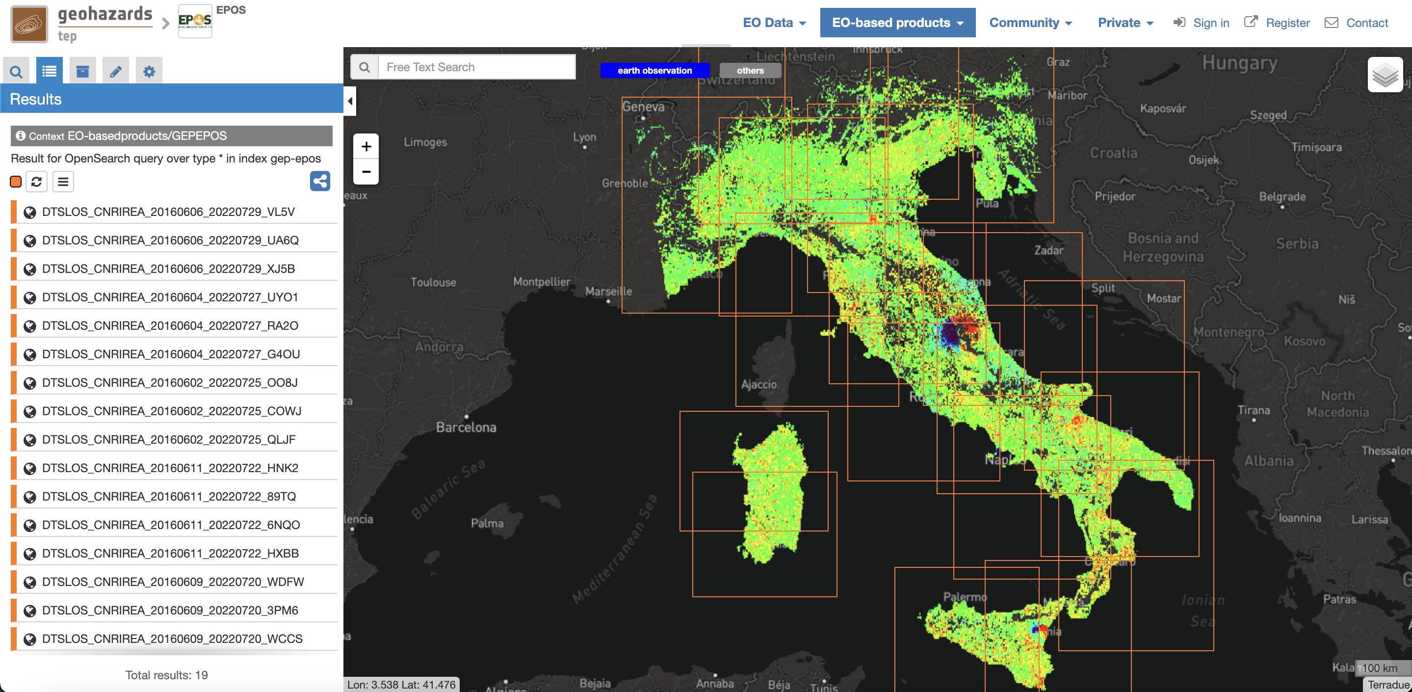
Geobrowser of the Geohazards Exploitation Platform that will represent the gateway of the TCS Satellite Data. The figure shows an example of the TCS products accessible through the GEP and is relevant to the displacement time series generated by the EPOSAR service in Italy.