Comprehensive earthquake hazard and risk assessments are crucial to reducing the effects of catastrophic earthquakes. A core team of researchers from different institutions across Europe worked collaboratively to develop the first openly available Seismic Risk Model for Europe and to update Europe’s Seismic Hazard Model.
These tools significantly improve the understanding of where strong shaking is most likely to occur and what effects future earthquakes in Europe will have. The research has been funded by the European Union’s Horizon 2020 research and programme.
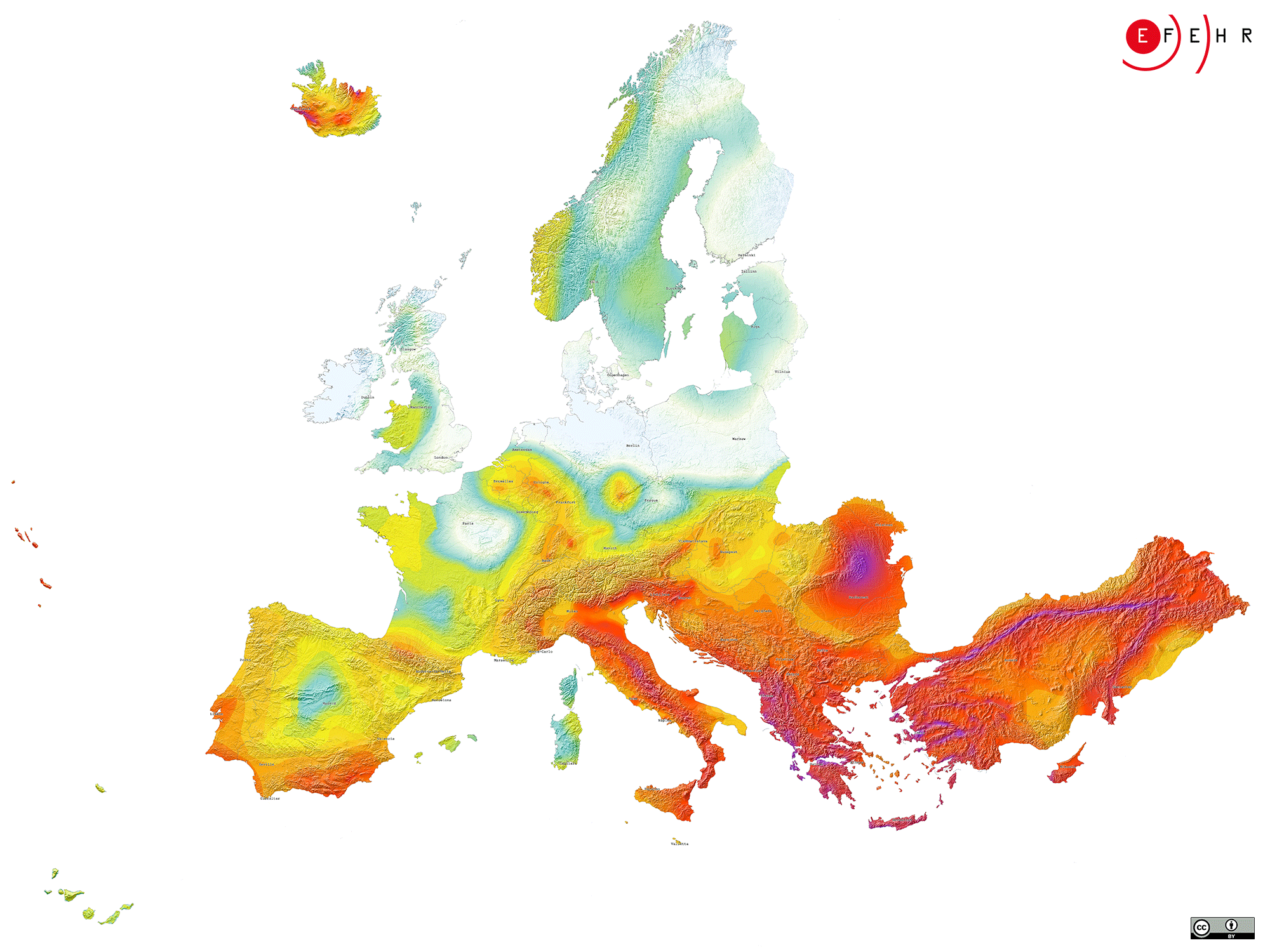
Earthquakes cannot be prevented nor precisely predicted, but efficient mitigation measures informed by earthquake hazard and risk models can significantly reduce their impacts. The 2020 European Seismic Hazard and Risk Models offer comparable information on the spatial distribution of expected levels of ground shaking due to earthquakes, their frequency as well as their potential impact on the built environment and on people’s wellbeing. To this aim, all underlying datasets have been updated and harmonised – a complex undertaking given the vast amount of data and highly diverse tectonic settings in Europe.
Open access is provided to both, the European Seismic Hazard and Risk Models, including various initial components such as input datasets. The updated earthquake hazard model benefits from advanced datasets.
The European Facilities for Earthquake Hazard and Risk (EFEHR) maintains and will further develop the earthquake hazard and risk model for Europe in collaboration with the GEM Foundation and EPOS. EFEHR is a non-profit network of organisations and community resources aiming to advance assessments of earthquake hazard and risk in the European-Mediterranean area.
Explore the updated earthquake hazard and the new earthquake risk map here.